Sri Lanka, officially known as the Democratic Socialist Republic of Sri Lanka, is a captivating island country located in the Indian Ocean, just off the southeastern coast of India. Belonging to the region of South Asia, it is one of the most beautiful and ecologically rich Asian countries. From lush central highlands and sprawling sandy beaches to an extensive network of rivers, this nation is a land of contrasts and cultural depth. Whether you’re navigating ancient temples, tea-covered hills, or coastal retreats, each journey reveals the rich tapestry found across this remarkable map. Designer Journeys will guide you through these landscapes with thoughtfully designed experiences that highlight the very best of what Sri Lanka map has to offer. Understanding the map of Sri Lanka provides more than just geographical context—it unveils a land shaped by ancient history, diverse ethnic groups, and a unique administrative structure.
Geographic Location and Boundaries
Position in the Indian Ocean
When examining the location of Sri Lanka, it becomes clear why the island has played a key role in maritime trade and geopolitics. It lies between latitudes 5° and 10° N and longitudes 79° and 82° E, bounded by the Bay of Bengal to the northeast and the Gulf of Mannar to the northwest. The Palk Strait separates it from India, while the Maldives lies southwest, forming a maritime triangle of strategic importance.
The island’s geography includes a central highland region with a unique arrangement.
The island’s proximity to India is particularly significant, with the Palk Strait separating the two nations by merely 50 kilometres at its narrowest point. This geographical relationship, particularly the Palk Strait, has profoundly influenced Sri Lanka’s culture, politics, and economic development throughout its history. The shallow waters of the Palk Strait have facilitated cultural exchange while also serving as a natural barrier, allowing Sri Lanka to maintain its distinct identity
Are you planning a trip to Sri Lanka?
Browse our gallery of fully customisable Sri Lanka itineraries and connect with one of our expert Local Designers to get you started! Designer Journeys can design your ultimate experience and offers hand-crafted itineraries built by experienced Local Designers who have first-hand knowledge of the destination.
Surrounding Waters and Maritime Boundaries
Several important maritime features define the waters surrounding Sri Lanka. To the northwest lies the Gulf of Mannar, a shallow bay that serves as a biological treasure trove with its coral reefs and marine ecosystems, known as the gulf of mannar. The Bay of Bengal stretches to the northeast, whilst the vast expanse of the Indian Ocean surrounds the southern and western coasts.
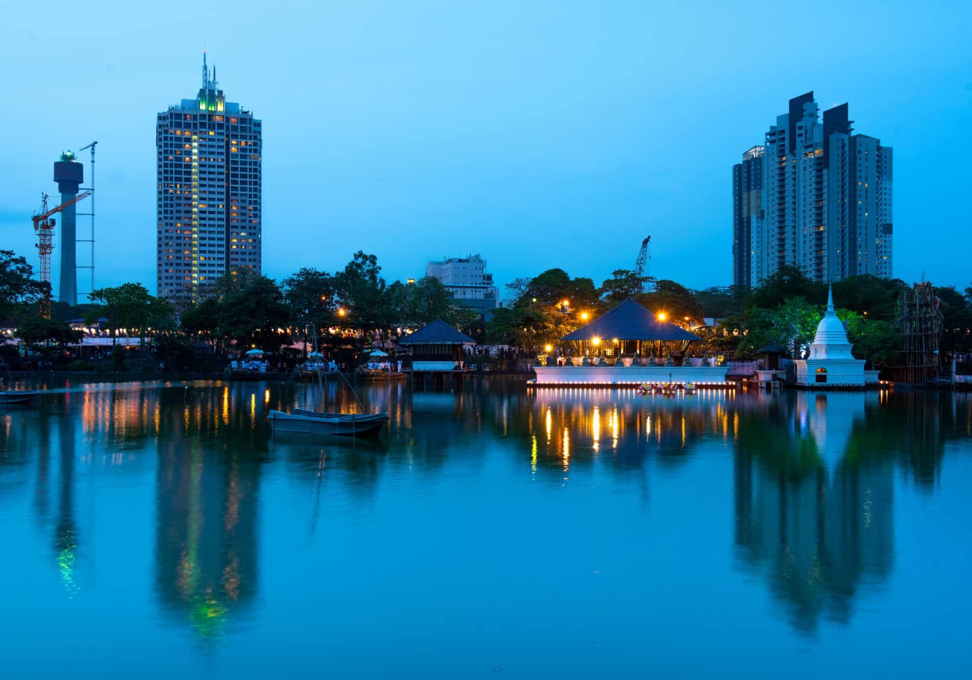
Sri Lanka is an island country in South Asia, located in the Indian Ocean.
The Bay of Bengal’s monsoon systems significantly influence Sri Lanka’s weather patterns, bringing crucial rainfall during the northeast monsoon period. The deeper waters of the bay also support important commercial fishing activities and serve as a route for international shipping.
To the south and west, the vast expanse of the Indian Ocean surrounds the island, providing unlimited maritime access to global markets. These waters are among the world’s busiest shipping lanes, with thousands of vessels passing near Sri Lankan waters annually. The deep-water ports along the southern and western coasts take advantage of these shipping routes, positioning Sri Lanka as a potential transhipment hub for the region.


Administrative Divisions and Capitals
The Three-Capital System
Unlike most countries, Sri Lanka has more than one capital city. Its legislative capital is Sri Jayawardenepura Kotte, a suburb of Colombo, which serves as the executive and commercial capital. Meanwhile, Galle is often considered a judicial capital, symbolising the colonial heritage and modern-day legal framework. With a metropolitan population exceeding 750,000, Colombo handles the majority of the country’s international trade and serves as the primary gateway for foreign investment.
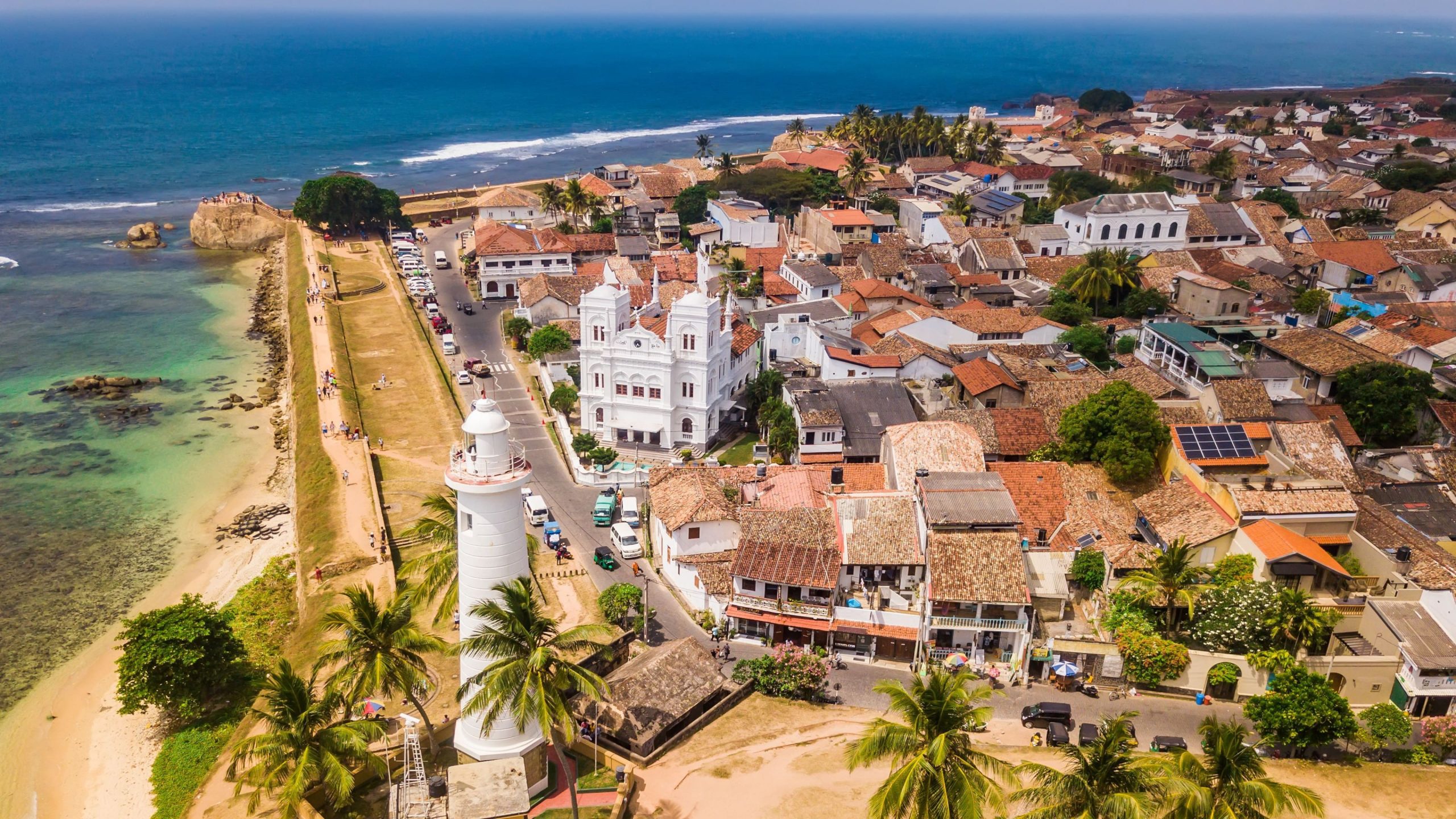
The fort is situated right on the coast, with a long sea wall and a beach.
Sri Jayawardenepura Kotte functions as the legislative capital, housing the Parliament of Sri Lanka and serving as the seat of government administration. Located just southeast of Colombo, this purpose-built capital represents the country’s commitment to separating commercial and governmental functions whilst maintaining proximity for efficient coordination.
The city was originally known as Kotte and served as the capital of the Sinhalese kingdom from 1415 to 1565.
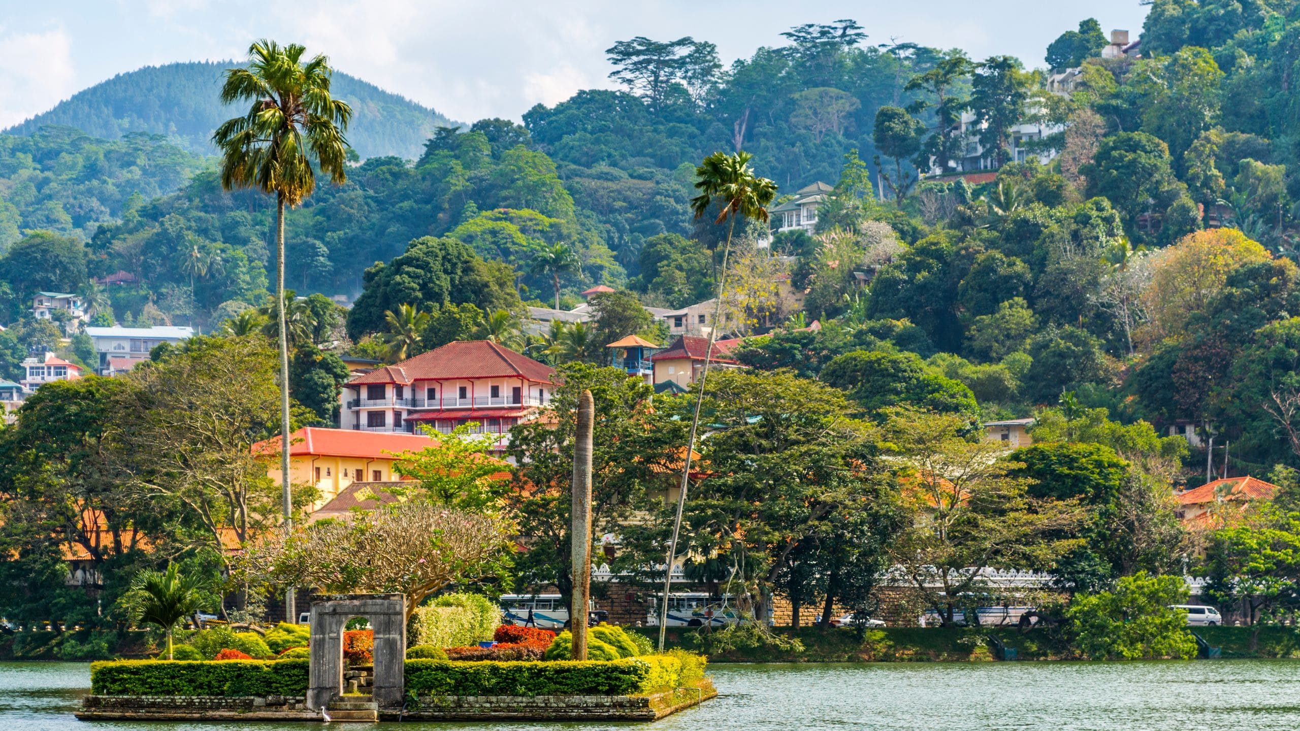
Kandy, designated as the cultural capital, represents the nation’s rich heritage and traditional values. This ancient city, nestled in the central highlands, served as the last kingdom of Sri Lanka before British colonisation and continues to be revered as the spiritual heart of the island. The Temple of the Sacred Tooth Relic in Kandy remains one of the most important Buddhist pilgrimage sites in the world.
Nuwara Eliya, also known as “Little England,” is a hill station in the central highlands with a cool climate.
This tri-capital arrangement reflects the complex administrative needs of modern Sri Lanka whilst acknowledging its historical and cultural diversity. Colombo, as the primary port city, handles the majority of the country’s international trade and serves as the economic hub. The legislative capital houses the parliament and key governmental institutions, whilst Kandy preserves the cultural and religious traditions that define Sri Lankan identity.
Provincial Structure
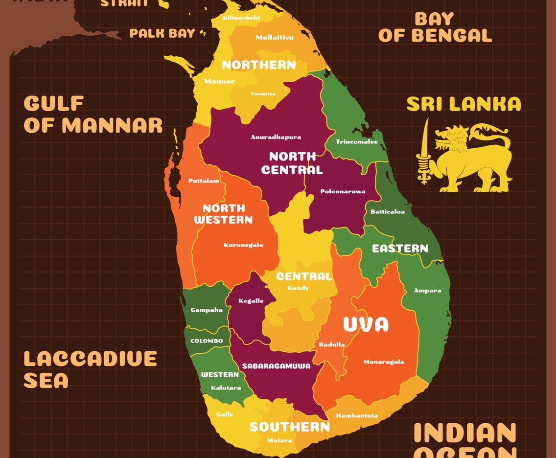
It is important to note that Sri Lanka is divided into nine provinces, each with its own distinct geographical characteristics and cultural identity. The Western Province, which includes Colombo, represents the most densely populated and economically significant region. The Central Province encompasses the central highlands and includes the former royal capital of Kandy.
The Northern and Eastern provinces have unique demographic compositions and have played crucial roles in the country’s recent history. The Southern Province is renowned for its coastal beauty and historical significance, whilst the North Western and North Central provinces represent important agricultural regions.
District Administration
For administrative purposes, Sri Lanka is subdivided into 25 districts, each serving specific governmental and administrative functions. This district system allows for more localised governance and ensures that the diverse needs of different regions are adequately addressed.
The district system reflects the geographical diversity of the island, with some districts encompassing mountainous terrain, others focusing on coastal areas, and several dedicated to agricultural plains. This administrative structure enables efficient resource allocation and targeted development programmes that consider local geographical and economic conditions.
Topographical Features and Terrain
The Central Highlands
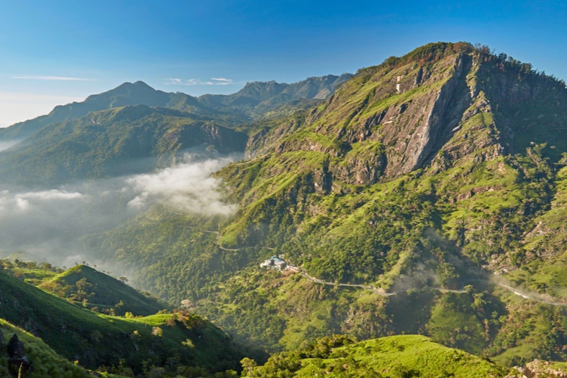
A physical map of Sri Lanka vividly illustrates its dramatic geography. In the heart of the island lies the central highlands, home to tea plantations, cloud forests, and the highest point in Sri Lanka—Pidurutalagala, which rises 2,524 metres above sea level. Radiating outward from these highlands, the terrain transitions into lowlands, coastal plains, and beaches.
The mountain is located in the central highlands of Sri Lanka, overlooking the town of Nuwara Eliya.
The terrain in this region is characterised by steep slopes, deep valleys, and rolling hills that create a landscape of extraordinary beauty. Tea plantations carpet these hills, creating a patchwork of green that has become synonymous with Sri Lankan agriculture. The higher altitudes in this region experience a temperate climate that contrasts sharply with the tropical conditions found at sea level, allowing for the cultivation of crops that require cooler temperatures.
The geological formation of the central highlands dates back millions of years, with ancient rocks and complex geological processes creating the diverse terrain visible today. The highlands include several distinct mountain ranges, including the Knuckles Range, which has been designated as a UNESCO World Heritage Site due to its exceptional biodiversity and unique ecosystem.
Coastal Plains and Sandy Beaches
It is undeniable: Lanka is an island. The country is completely surrounded by water, with a coastline that stretches over 1,340 kilometres. This feature not only influences its climate but also fosters a rich fishing and tourism industry. The coastal plains vary in width around the island, with the western and southwestern parts featuring broader plains that have supported dense population centres and extensive agricultural activities.
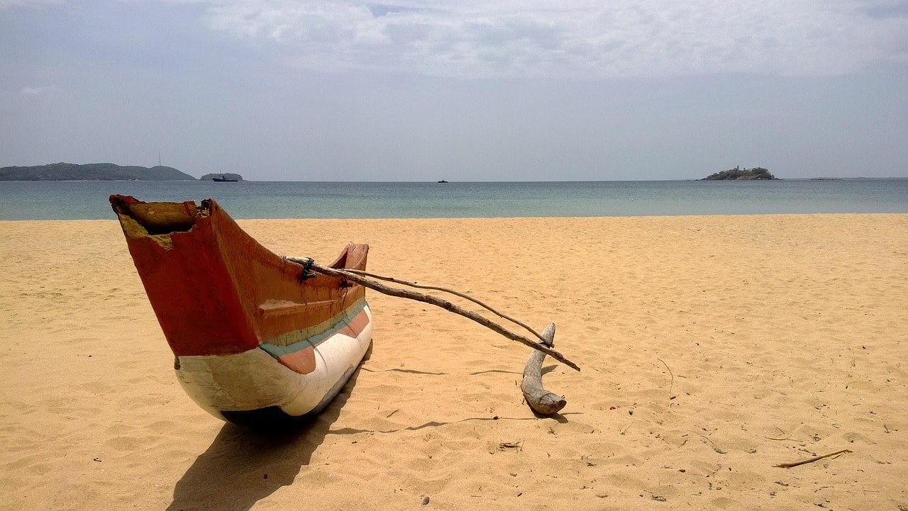
Sri Lanka has a diverse coastline with both sandy and rocky beaches.
The southwestern coastline is particularly renowned for its palm-fringed beaches, coral reefs, and lagoons that create ideal conditions for tourism and fishing. These coastal areas represent not only natural beauty but also economic opportunity, supporting industries ranging from tourism to aquaculture.
River Systems and Waterways
Sri Lanka has an extensive network of rivers that originate primarily in the central highlands and flow towards the sea through various valleys and plains. The longest river, the Mahaweli, flows for 335 kilometres from its source in the central highlands to its mouth on the east coast. This river has been crucial for the country’s agricultural development and hydroelectric power generation, with the Mahaweli Development Programme representing one of the largest river basin development projects in South Asia.
The major rivers of Sri Lanka include the Kelani, which flows through Colombo and serves as an important water source for the commercial capital; the Kalu Ganga, which drains the southwestern wet zone; the Walawe, which supports extensive rice cultivation in the southern dry zone; and the Deduru, which flows through the northwestern coastal plains.
These waterways have shaped settlement patterns throughout Sri Lankan history, with ancient cities and modern towns typically located along river valleys where fertile soils and reliable water supplies support agriculture and human habitation. The rivers also serve important transportation functions, particularly in rural areas where roads may be limited.
Climate Zones and Weather Patterns
The Wet Zone
Sri Lanka experiences a tropical climate with regional variations. The wet zone in the southwestern parts receives heavy rainfall, especially during the August monsoon, while the dry zone in the northern and eastern areas relies on irrigation. This region experiences annual precipitation levels exceeding 2,500 millimetres, creating lush landscapes that support diverse ecosystems and intensive agriculture. The wet zone covers approximately 25% of the island’s total area but supports nearly 70% of the population due to its favourable climate and fertile soils.
The wet zone’s climate supports the cultivation of tea, rubber, and various spice crops that have historically driven Sri Lanka’s export economy. The consistent moisture levels in this region also sustain tropical rainforests that harbour exceptional biodiversity and serve as important carbon sinks. These forests include some of the world’s most biodiverse ecosystems, with endemic species found nowhere else on Earth.
The region experiences two distinct wet seasons: the southwest monsoon from May to September and the northeast monsoon from December to February. Between these periods, intermonsoon rains provide additional moisture, ensuring that vegetation remains lush throughout the year.
The Dry Zone
The dry zone covers the northern and eastern parts of the country, representing approximately 75% of Sri Lanka’s total land area. This region receives significantly less rainfall than the wet zone, with annual precipitation typically ranging from 1,200 to 1,900 millimetres, concentrated during the northeast monsoon period from October to January.
Despite receiving less rainfall, the dry zone supports important agricultural activities, including rice cultivation in irrigated areas and extensive cattle farming. The region’s lower population density reflects the challenges of securing reliable water supplies and the seasonal nature of rainfall. However, the dry zone includes some of Sri Lanka’s most important archaeological sites and supports significant wildlife populations in its national parks.
Ancient irrigation systems, including massive reservoirs called tanks, demonstrate the ingenuity of past civilisations in managing water resources in this challenging environment. These systems, some dating back over 2,000 years, continue to support agriculture and serve as important wildlife habitats during dry periods.
Intermediate Zone
Between the wet and dry zones lies the intermediate zone, which experiences moderate rainfall levels and serves as a transition area between the two major climate regions. This zone supports mixed agricultural systems and contains important biodiversity corridors that connect ecosystems across different climate zones.
The intermediate zone receives annual rainfall between 1,900 and 2,500 millimetres, supporting agriculture that combines elements of both wet and dry zone farming systems. This region is particularly important for spice cultivation, including cinnamon, cardamom, and pepper, which thrive in the moderate climate conditions.
The intermediate zone includes important watershed areas that feed rivers flowing to both the wet and dry zone regions. Protection of these watersheds is crucial for maintaining water supplies across the island and supporting the diverse ecosystems that depend on reliable water sources.
Design your perfect Sri Lanka trip today!
Work with your expert local travel designer to customise your itinerary so it is exactly what you want from a Sri Lanka trip. Get exclusive experiences, top-rated restaurants, and hotels that fit your interests.
Cultural and Historical Geography
Ancient Kingdoms and Historical Sites
Sri Lanka’s map is dotted with archaeological sites and ancient cities that tell the story of sophisticated civilisations that flourished on the island for over two millennia, and together, they constitute a rich historical narrative. Anuradhapura, located in the north-central region, served as the capital of ancient Sri Lanka for over 1,300 years and remains one of the world’s oldest continuously inhabited cities.
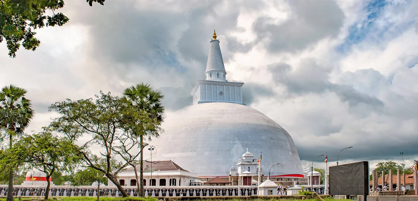
It was the center of Theravada Buddhism for many centuries and is a UNESCO World Heritage site.
Polonnaruwa, another ancient capital, showcases the architectural and engineering achievements of medieval Sri Lankan civilisation. These historical sites are not merely tourist attractions but represent living connections to the island’s rich cultural heritage and demonstrate the sophisticated urban planning and hydraulic engineering capabilities of ancient Sri Lankan societies.
Colonial Legacy and Modern Development
The period of European colonisation, spanning over 400 years from Portuguese arrival in 1505 to independence in 1948, significantly influenced Sri Lanka’s modern geographical and administrative structure. Each colonial power left distinct architectural and cultural legacies that remain visible across the island today.
Portuguese influence is most evident in coastal areas, particularly in the southwestern regions where they established their first settlements. Colonial churches, fortifications, and administrative buildings from this period reflect European architectural styles adapted to tropical conditions. The Portuguese also introduced new crops and agricultural techniques that continue to influence Sri Lankan farming practices.
Dutch colonial architecture is particularly well-preserved in areas such as Galle, where the Dutch Fort represents one of the best-preserved colonial fortifications in Asia. The Dutch also developed extensive canal systems and administrative structures that influenced the island’s development patterns. Their systematic approach to land administration and agricultural development established patterns that continue to influence modern land use.
Religious Geography and Sacred Landscapes
Sri Lanka’s religious geography reflects the island’s position as a centre of Buddhist civilisation whilst also encompassing diverse religious traditions brought by various communities throughout history. Buddhist temples and monasteries are distributed across the island, with particularly important sites located in ancient cities and pilgrimage routes that connect sacred locations.
The Temple of the Sacred Tooth Relic in Kandy represents the most important Buddhist site in Sri Lanka and attracts pilgrims from across the Buddhist world. The annual Esala Perahera festival demonstrates the continued vitality of religious traditions and their importance in contemporary Sri Lankan culture.
Hindu temples, particularly in the northern and eastern regions, reflect the island’s Tamil heritage and connections to South Indian religious traditions. These temples often feature distinctive Dravidian architectural styles and serve as important community centres for Tamil-speaking populations.
Biodiversity and Natural Resources
Endemic Species and Ecological Uniqueness
Sri Lanka’s compact size belies its extraordinary biodiversity, with the island containing multiple climate zones and ecosystems that support a remarkable array of flora and fauna. The country is recognised as one of the world’s biodiversity hotspots, with exceptionally high levels of endemism across various species groups. Over 25% of flowering plants, 50% of freshwater fish, and numerous bird, reptile, and amphibian species are found nowhere else on Earth.
The island’s geological history, including its separation from the Indian mainland millions of years ago, has contributed to the evolution of unique species and ecosystems. The central highlands, in particular, harbour numerous endemic species adapted to montane conditions, including several species of birds, frogs, and plants that have evolved in isolation.
Tropical rainforests in the wet zone support exceptional biodiversity, with complex ecological relationships between plants, animals, and microorganisms. These forests include multiple canopy layers, each supporting different communities of species and contributing to the overall complexity of forest ecosystems.
National Parks and Protected Areas
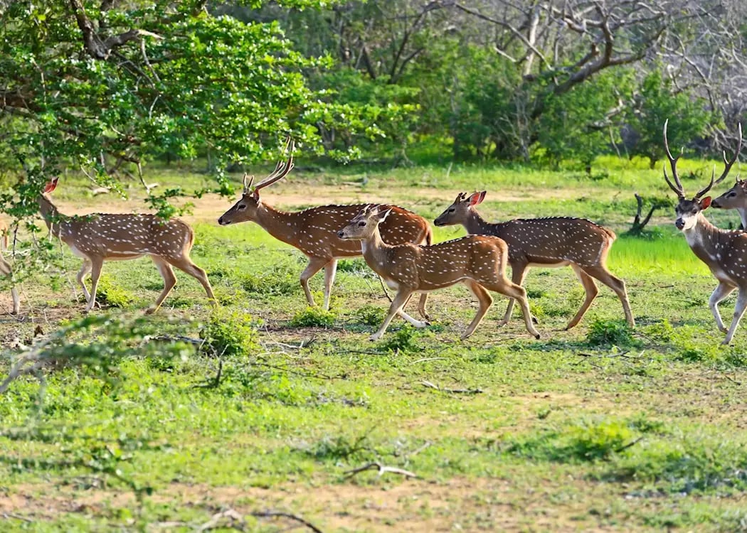
Sri Lanka has established an extensive network of national parks and protected areas that preserve critical habitats and endangered species across different ecological zones. These protected areas cover approximately 12% of the island’s total land area and represent diverse ecosystems from coastal mangroves to montane forests.
The park’s landscape includes grassy plains with watering holes, and rocky outcrops amidst greenery.
Yala National Park in the southeast is renowned for having one of the world’s highest leopard densities and supports diverse wildlife, including elephants, crocodiles, and numerous bird species. The park’s varied habitats, from coastal lagoons to thorny scrublands, demonstrate the ecological diversity that can be found within a single protected area.
Sinharaja Forest Reserve in the southwest protects one of the last remaining tropical rainforests on the island and has been designated as both a UNESCO World Heritage Site and a Biosphere Reserve. This forest contains exceptional biodiversity and serves as an important research site for tropical ecology and conservation biology.
Forest Resources and Conservation
Forests once covered the majority of Sri Lanka’s landmass, but centuries of human activity have reduced forest cover to approximately 29% of the total land area. The remaining forests are classified into several categories, including tropical rainforests, montane forests, dry zone forests, and mangrove forests, each supporting unique ecosystems and species assemblages.
Forest ecosystems provide crucial services beyond biodiversity conservation, including watershed protection, carbon storage, and climate regulation. The central highlands forests are particularly important for maintaining water supplies to rivers that serve both wet and dry zone agriculture and urban areas.
Mangrove forests along the coast provide important protection against coastal erosion and storm surges whilst supporting productive fisheries and serving as nursery areas for marine species. These forests have been increasingly recognised for their role in climate change adaptation and coastal zone management.
Economic Geography and Resource Distribution
Agricultural Landscapes and Crop Specialisation
Agriculture remains a cornerstone of Sri Lanka’s economy and rural livelihoods, and lanka has an extensive distribution of agricultural activities across the island. The distribution of agricultural activities across the island reflects the close relationship between physical geography and economic activity that has characterised Sri Lankan society for millennia.
The central highlands are dominated by tea plantations that produce some of the world’s finest Ceylon tea, generating significant export revenue and supporting hundreds of thousands of workers. Tea cultivation requires specific climatic conditions, including consistent rainfall, moderate temperatures, and well-drained soils found in the highland regions above 600 metres in elevation. The plantation industry, established during British rule, continues to be a major economic sector whilst facing challenges related to labour costs, productivity, and market competition.
Industrial Development and Manufacturing Zones
Industrial development in Sri Lanka has historically concentrated in the Western Province, particularly around Colombo and its surrounding areas. This concentration reflects the advantages of port access, infrastructure availability, and skilled labour pools that have developed in these regions over decades of economic development.
The textile and garment industry represents Sri Lanka’s largest manufacturing sector, with production facilities concentrated in and around Colombo as well as in designated industrial zones throughout the country. This industry has been crucial for export earnings and employment generation, particularly for women workers in rural areas.
Free Trade Zones established in various locations have attracted foreign investment and promoted export-oriented manufacturing. These zones provide infrastructure, utilities, and administrative support for manufacturers producing goods for international markets. The success of these zones has led to their expansion and the development of additional industrial parks in different provinces.
Mining and Mineral Resources
Sri Lanka’s geological history has endowed the island with valuable mineral resources that have contributed to the economy for centuries. The most famous of these resources are precious gems, including sapphires, rubies, and various semi-precious stones that have been mined in the central highlands and surrounding areas for over 2,000 years.
Gem mining in Sri Lanka involves both traditional small-scale operations and more modern commercial enterprises. The gem-bearing gravels are found in various locations, with the most productive areas located in the Ratnapura district and surrounding regions. Sri Lankan sapphires are particularly prized for their quality and variety of colours.
Graphite deposits, primarily located in the southwestern parts of the island, have historically supported important export industries. Sri Lankan graphite is known for its high purity and has been used in various industrial applications, including steel production, batteries, and lubricants. Mining operations have evolved from small-scale traditional methods to larger commercial operations that employ modern extraction and processing techniques.
Transportation Networks and Connectivity
Road Infrastructure
Sri Lanka’s road network has evolved over centuries to connect all major population centres and economic regions, though the quality and capacity of roads vary significantly across different parts of the island. The total road network extends over 100,000 kilometres, ranging from major highways to rural access roads that serve remote communities.
The A-grade roads form the backbone of the national highway system, connecting major cities and facilitating inter-provincial trade and movement. These roads include the A1 highway from Colombo to Kandy and beyond to Jaffna, the A2 coastal road connecting Colombo to Galle and Matara, and the A4 highway linking Colombo to the eastern city of Batticaloa.
Highway development has been a priority for recent governments, with several major projects completed to improve connectivity and reduce travel times between major centres. The Southern Expressway, connecting Colombo to Galle, represents the country’s first modern expressway and has significantly reduced travel times to the southern coast.
Railway System
The railway system, established during British rule, continues to play an important role in passenger The railway system, established during British rule in the mid-19th century, continues to play an important role in passenger transportation and freight movement across the island of Sri Lanka. The railway network covers approximately 1,500 kilometres and connects most major population centres, though service quality and efficiency vary considerably across different routes.
The main railway line connects Colombo to Kandy and extends to various other destinations, including the hill country tea-growing regions and the eastern coast. The journey from Colombo to Kandy, winding through mountainous terrain and tea plantations, is considered one of the world’s most scenic railway routes and attracts thousands of tourists annually.
The railway network not only serves transportation needs but also represents an important tourist attraction, with scenic routes through the central highlands offering spectacular views of tea plantations, mountains, and valleys. The slow pace of train travel allows passengers to appreciate the changing landscapes and provides access to areas that might be difficult to reach by road.
Ports and Maritime Infrastructure
Sri Lanka’s strategic location has made its ports crucial for international trade and regional connectivity throughout history. The country’s natural harbours and strategic position along major shipping routes have supported maritime trade for over two millennia, from ancient Arab and Chinese traders to modern container shipping.
The Port of Colombo serves as the primary commercial gateway, handling approximately 80% of the country’s international trade and serving as a major transhipment hub for regional cargo. The port has undergone significant expansion and modernisation, including the development of the South Asia Gateway Terminal, which can accommodate the world’s largest container vessels.
Hambantota Port in the deep south represents a major infrastructure investment designed to take advantage of Sri Lanka’s strategic location and serve as an additional hub for international shipping. The port includes facilities for container handling, bulk cargo, and oil transhipment, positioning Sri Lanka as a major maritime service centre for the Indian Ocean region.
Environmental Challenges and Conservation
Climate Change Impacts
As an island nation in the tropical Indian Ocean, Sri Lanka faces particular vulnerability to climate change impacts that threaten both human communities and natural ecosystems. Rising sea levels pose direct threats to coastal areas where approximately 75% of the population lives and most economic activities are concentrated.
Sea-level rise projections suggest that significant coastal areas could be affected within decades, potentially displacing hundreds of thousands of people and threatening critical infrastructure, including ports, airports, and urban centres. Coastal erosion, already evident in many areas, is expected to accelerate with rising sea levels and changing storm patterns.
Changing precipitation patterns present challenges for agriculture, water resources, and hydroelectric power generation. The central highlands, which serve as the island’s primary water source, may experience altered rainfall patterns that affect river flows and reservoir levels. These changes could impact both wet zone plantation agriculture and dry zone irrigated farming.
Water Resource Management
Water resource management represents one of Sri Lanka’s most critical environmental challenges, with competing demands from agriculture, industry, urban populations, and ecosystem preservation. The extensive network of ancient irrigation systems demonstrates historical sophistication in water management, but modern challenges require updated approaches and technologies.
Sustainable water management strategies focus on protecting watersheds, improving irrigation efficiency, reducing pollution, and developing alternative water sources. These efforts are essential for supporting continued economic development whilst preserving environmental quality.
Waste Management and Pollution Control
Water resource management represents one of Sri Lanka’s most critical environmental and development challenges, with competing demands from agriculture, industry, urban populations, and ecosystem preservation. The island’s water resources are finite and subject to seasonal and inter-annual variations that require careful management and conservation.
The extensive network of ancient irrigation systems demonstrates historical sophistication in water management, but modern challenges require updated approaches and technologies. Many ancient tanks and canals require rehabilitation and upgrading to meet contemporary needs whilst preserving their historical and cultural significance.
Urban water supply systems face increasing pressure from population growth, economic development, and changing consumption patterns. Colombo and other major cities require significant investment in water treatment, distribution, and wastewater management systems to ensure reliable supplies and protect public health.
Tourism Geography and Cultural Attractions
Coastal Tourism Development
Sri Lanka’s sandy beaches and coastal areas represent the foundation of the country’s tourism industry, attracting visitors from around the world, many of whom speak the official languages, seeking tropical paradise experiences. The southwestern and southern coasts are particularly well-developed for tourism, with numerous hotels, restaurants, and recreational facilities.
Coastal tourism development has brought economic benefits to many communities but also presents challenges related to environmental protection, cultural preservation, and sustainable development. Balancing tourism growth with environmental and social considerations remains an ongoing challenge.
Cultural Tourism and Heritage Sites
The island’s rich cultural heritage provides the basis for significant cultural tourism, with ancient cities, religious sites, and traditional communities attracting visitors interested in history, archaeology, and cultural experiences. UNESCO World Heritage Sites, including ancient cities and natural areas, represent particularly important tourism assets.
Cultural tourism development aims to provide economic benefits to local communities whilst preserving the authenticity and integrity of cultural sites and traditions. This approach requires careful planning and management to ensure that tourism contributes positively to cultural preservation and community development.
Future Challenges and Opportunities
Sustainable Development Goals
Sri Lanka faces the challenge of achieving sustainable development that balances economic growth, social equity, and environmental protection. The country’s geography presents both opportunities and constraints for sustainable development, requiring careful planning and resource management.
Key opportunities include leveraging the strategic location for trade and logistics, developing renewable energy resources, and promoting sustainable tourism. Challenges include managing population growth, protecting natural resources, and adapting to climate change impacts.
Regional Integration and Global Connectivity
Sri Lanka’s position in the Indian Ocean provides significant opportunities for regional integration and global connectivity. The country can serve as a bridge between South Asia, Southeast Asia, and the broader Indian Ocean region, facilitating trade, investment, and cultural exchange.
Realising these opportunities requires continued investment in infrastructure, education, and institutional capacity. Regional cooperation initiatives and international partnerships will be crucial for maximising the benefits of Sri Lanka’s strategic geographic position.
Don’t Miss Our Exclusive Offers! Subscribe Today!
For the ultimate travel inspiration, local insight straight from our expert Local Designers and exclusive offers you won’t find anywhere else from Designer Journeys, sign up today! Don’t miss out.
Sri Lanka map reveals a nation of extraordinary complexity and beauty, where geography has shaped history, culture, and economic development in profound ways. From the misty peaks of the central highlands to the palm-fringed shores of the coast, every feature on the map tells a story of natural processes, human adaptation, and cultural evolution.
Understanding Sri Lanka’s geography is essential for appreciating the challenges and opportunities facing this island nation. The interplay between physical geography, climate, and human activities has created a unique landscape that supports remarkable biodiversity, diverse cultures, and economic activities ranging from ancient agriculture to modern services.
As Sri Lanka continues to develop and face new challenges, its geography will remain a fundamental factor shaping the nation’s future. The key to sustainable development lies in understanding and working with geographical realities whilst leveraging the island’s strategic advantages and natural resources responsibly.
The pearl of the Indian Ocean continues to evolve, and its map will undoubtedly reflect new developments, challenges, and achievements in the years to come. Through careful stewardship of its geographical assets and thoughtful planning for the future, Sri Lanka can continue to thrive as one of the world’s most remarkable island nations.